City-Scale Traffic Animation Using Statistical Learning and Metamodel-Based Optimization
Weizi Li,
David Wolinski, and
Ming C. Lin
University of North Carolina at Chapel Hill
Abstract
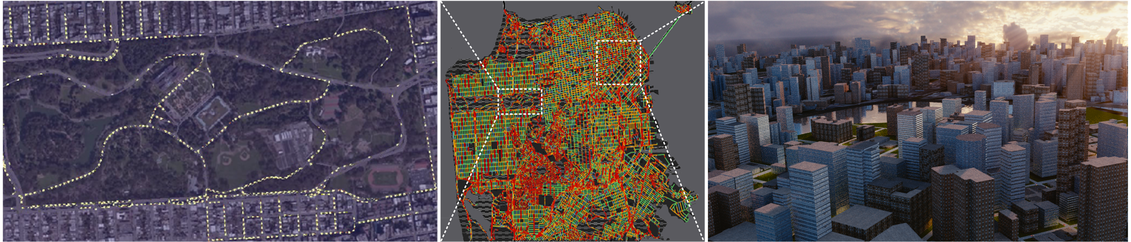
Rapid urbanization and increasing traffic have caused severe social, economic, and environmental problems in metropolitan areas worldwide. Traffic reconstruction and visualization using existing traffic data can provide novel tools for vehicle navigation and routing, congestion analysis, and traffic management. While traditional data collection methods are becoming increasingly common (e.g. using in-road sensors), GPS devices are also becoming ubiquitous. In this paper, we address the problem of traffic reconstruction, visualization, and animation using mobile vehicle data (i.e. GPS traces). We first conduct city-scale traffic reconstruction using statistical learning on mobile vehicle data for traffic animation and visualization, and then dynamically complete missing data using metamodel-based simulation optimization in areas of insufficient data coverage. We evaluate our approach quantitatively and qualitatively, and demonstrate our results with 2D visualization of citywide traffic, as well as 2D and 3D animation of reconstructed traffic in virtual environments.
Publication
DOI, ACM Transactions on Graphics 36(6), 2017 (Proceedings of SIGGRAPH Asia 2017)Preprint (pdf, 8.0MB)
Appendix (pdf, 3.0MB)
Supplemental Video (mp4, 61.5MB)
BibTeX
Video
Simulation Resource
Download (zip, 16.4MB)
Acknowledgements
The authors would like to thank US Army Research Office and UNC Arts & Science Foundation.Related Links
GAMMA GroupTraffic Simulation, Reconstruction, and Route Planning